The tragic sequence of earthquake that last night August 24th struck central Italy involved four regions: Lazio, Abruzzo, Marche and Umbria.
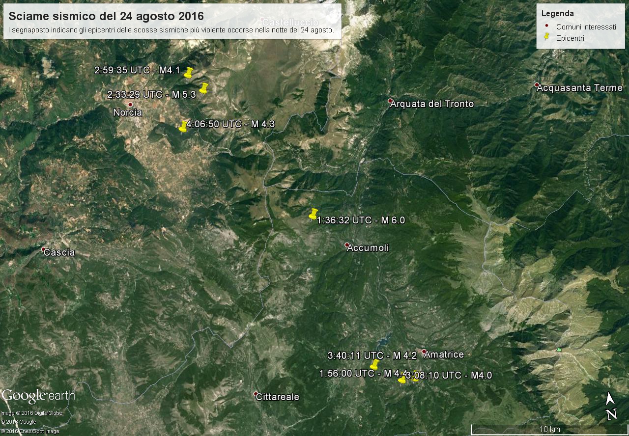
In particular, the first and most violent shock (Magnitude 6.0) has occurred in the Municipality of Accumoli in the Department of Rieti. Several aftershocks has followed these one as, for instance, the one of Magnitude 5.3 whose epicenter was in the plain of Castelluccio, in the municipality of Norcia.
As highlighted by the mark points in the satellite image gathered from Google Earth, the epicenters of the main aftershocks are aligned along a direct fault or along a system of direct faults NNW-SSE oriented, according with the distensile tectonic characterizing the evolution of Apennine chain.

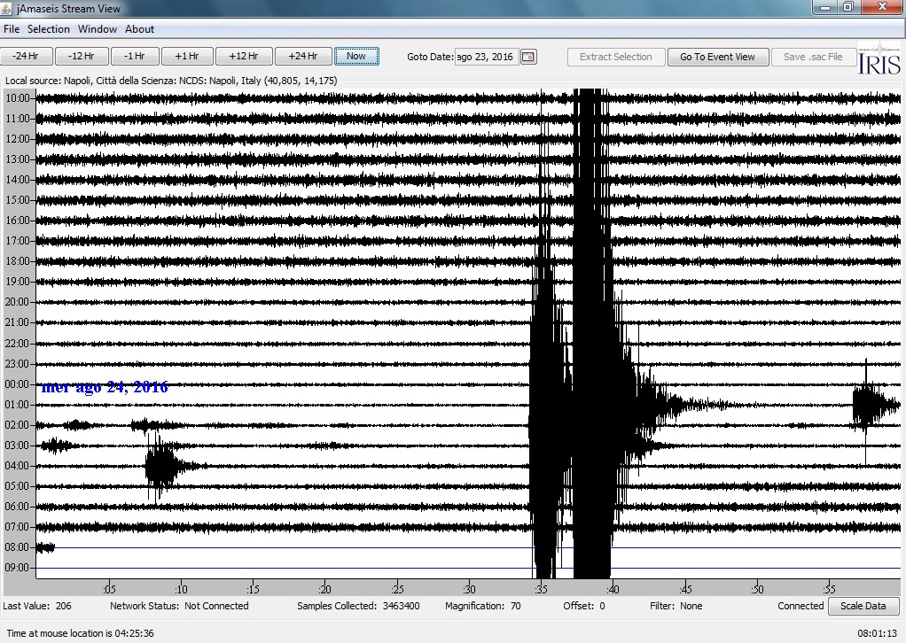
In this image showing the helicorder recorded along the last night by the seismic station of Città della Scienza many earthquakes are visible, in particular the strongest ones occurred respectively at 1:36 and 2:33 UTC.

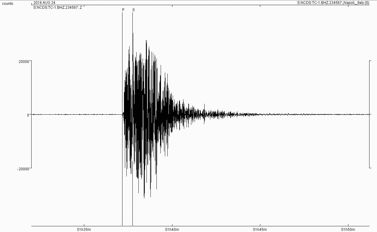
The next image shows the first main earthquakes of Magnitude 6.0. In the image are also marked the first arrivals of P and S waves that have reached the seismic station of Città della Scienza with a gap in time of around 28 second according with an epicentral distance of around 225 km.

NCDS the seismic station of Città della Scienza has been installed with educational tasks in the framework of the Erasmus+ project School Study Earthquakes. SSE involves six organizations from different countries of south-eastern Europe active both in research and in education.
The last images shows the recordings of the main earthquake done by the stations of the seismic network of the project seated in the National Observatory of Athens, in Città della Scienza and in the headquarters of the other partners in Turkey, Bulgaria and Cyprus.


